Bold actions created two York County Parks
Highpoint
1199 Hilts Road, Wrightsville
The situation
Settlers from Europe and parts of eastern Pennsylvania crossed the Susquehanna into future York County as early as 1719 and more after 1722.
But the migration west of the Susquehanna began in earnest after John Wright’s Ferry began operation between Columbia and Wrightsville in 1730.
These pioneers squatted or in some cases settled under legal Blunston licenses, temporary permits in anticipation of treaties between the Penns and the Iroquois in which it was agreed in 1736 that the purchase would include “All the land west of the Susquehanna to the setting sun.”
We can, thus, say that one strong thread of the story of land development by whites in future York County began on this formerly Native American-occupied land in those years.
Developers in these lands west of the Susquehanna got into a higher gear in 1739, when Ulrich Whissler and Baltzer Spengler traveled to Philadelphia to seek permission from the Penns to establish a town on the banks of the Codorus Creek.
The Penns acted on this request in 1741, ordering that a tract of land east of the Codorus be laid out in squares by surveyor Thomas Cookson. Twenty-three lots were “taken up” in late 1741, and the village of York was born.
Whissler and Spengler were chain bearers for Cookson and, for their efforts, received important lots – Whissler’s where the Colonial Courthouse stands today and Spengler’s on the northwest angle of the square. Thus came the reward or profit motive that has driven county land development – really, land development everywhere – to this day.
In 1739, another major action impacting land use arrived in the Penn family’s formation of Springettsbury Manor, a decision that reserved large swaths of land – originally 70,000 acres in future York County – for the Penns. This, and other such manors, guaranteed income via rents to the Penn family.
Of course, efforts to clear up land use and development covering well-watered York County’s original 1,400 square miles did not stop there.
Two surveyors became famous for their work on York County’s southern border. Mason and Dixon laid a 65-mile line through there, officially addressing a dispute between Pennsylvania and Maryland about what land was in which state. That dispute sometimes turned into violence as in Cresap’s War in future Lower Windsor and Hellam townships in 1736.
As the years passed, a battle between agrarianism and development heated up. Two 19th-century dates illustrate this.
In 1841 – a century after Cookson laid his lines – York County’s Centre Square courthouse, the square brick building in which Continental Congress adopted the Articles of Confederation in 1777, was demolished. A squad of men pulled down its cupola with a rope. But market sheds remained, indicating the preference for farmers to sell their produce in the heart of York just south of the center of York County.
But by 1887, the market sheds were pulled down by a rope driven by mule power. The Industrial Revolution was in full play in York, and those old market houses were blocking the flow of workers and product through that crossroads that led to each of the major compass points. So they came down in the middle of the night. That nocturnal demolition would solve that dispute.
But not really.
In just about 1983, half of the acreage in York County was used for development for the first time and prime land became increasingly valued. Particularly valued, that is, by developers who sought to seek scenic spots on formerly prime farm land. But valued also by a growing number of community-minded residents and a handful of public officials who sought to preserve this prime land for public use.
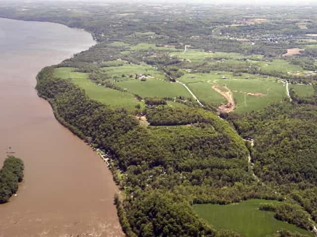
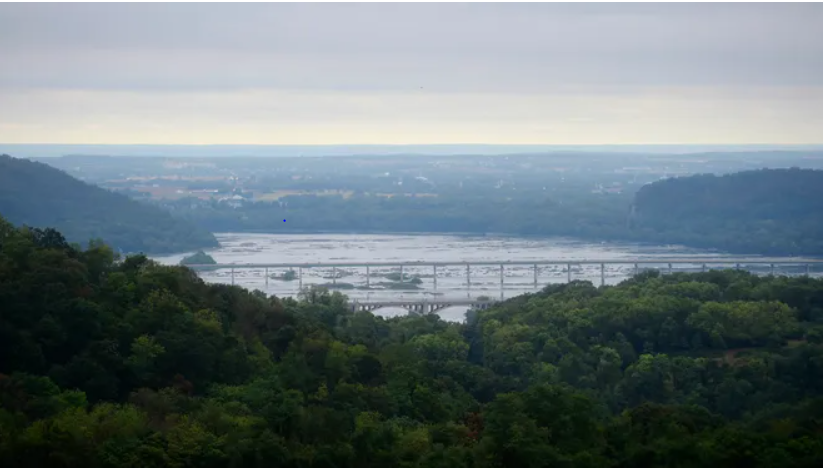
By about 2005, there was no other land left in York County more scenic than Highpoint and nearby Lauxmont farms, acreage overlooking the Susquehanna River in Lower Windsor Township.
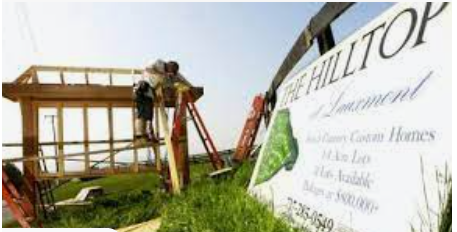
A developer saw an opportunity, acquired Highpoint and construction equipment moved onto its steep slopes. The plan was to build large houses there, called McMansions by some.
Indeed, work started, scarring this grassy hill. But those scenic 360 degree views that held such promise for development caught the attention of two county commissioners who saw the land as prime for the public.
A battle ensued that pitted county commissioners Lori Mitrick and Doug Kilgore and the owners of Highpoint and Lauxmont, an act of conviction that later cost them their elected positions. Actual and potential use of eminent domain had not been popular among land-loving county residents who did not like anyone telling them what to do with their property.
But the acquisition of both Highpoint and Lauxmont – at a cost of millions of dollars – set off a cascading effort that brought Highpoint and Native Lands parks into the county system.
Momentum surrounding preservation in that part of York County grew from there.
Private investment restored the old Dritt Mansion into the Zimmerman Center for Heritage and the region became part of gaining coveted National Heritage Area status, one of 55 such designated areas in America.
Most recently, Susquehanna National Heritage Area, the non-profit behind these preservation efforts, has been progressing in efforts to save the Mifflin House from development and to shape this Underground Railroad site into a visitors center.
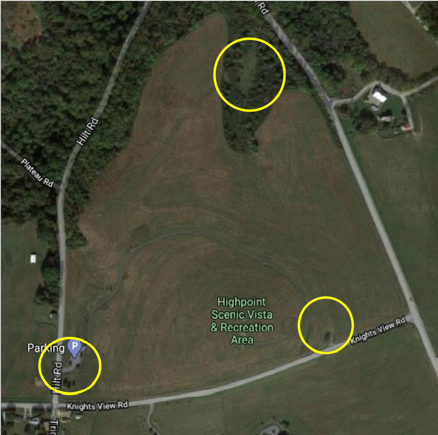
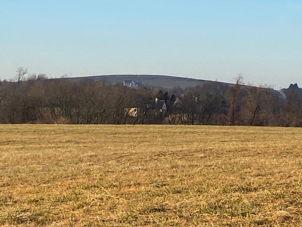
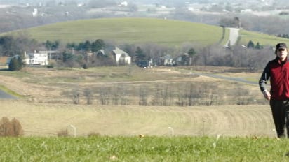
Those construction scars on Highpoint are still visible if you know where to look, reminders that big challenges – preservation of York County’s land and landmarks and its sense of place – often demand bold actions. Sometimes brave solutions come in big swaths and other times in increments. In either case, courage is needed.
Sometimes courageous decisions leave scars.
The witness
Mark Platts, who heads Susquehanna National Heritage Area and who has served as a common denominator for preservation back to the days of the Highpoint/Lauxmont disputes, provided this picture showing the last marks of construction – the scars – with a description in the caption.
Important witnesses are the users of Highpoint and Native Lands parks. Here’s a testimony from one reader, Charles (Chip) Kauffman, about a recent story on the two parks – “Parks teach downstream lessons”:
“I recall the rancor surrounding the Lauxmount Farm issue. Hard to believe it has been so many years already. Having grown up in Lancaster and having lived many years in Europe, one of the things my family and I have treasured since moving to York is the abundance of parks and open spaces. It is to the likes of Ms. Mitrick and Mr. Kilgore that we are indebted for taking on the challenges fraught with making the unpopular decisions to trade short-term gain in favor of the long-term vision for our county. We receive many visitors from Europe and I can assure you they all marvel at the beauty of Highpoint and Native Lands parks… . We are fortunate to have them nearby.”
The questions
The Highpoint/Lauxmont controversies stir strong feelings when it comes to land ownership. It’s the age-old controversy of open space v. development. One way to frame the debate: Who should have rights to valuable land? The people? Or the individuals who purchase it?
Are you supportive of eminent domain when it means that many, many people will enjoy the space? Or, does eminent domain unduly infringe on the rights of property owners even though eminent domain is done with the public in mind and property owners can receive higher payments for the land?
Related links and sources Neal Otto Hively’s “The Manor of Springettsbury;” James McClure’s “Never to be Forgotten.” All photos, unless otherwise noted, courtesy of the York Daily Record.
— By JAMIE NOERPEL and JIM McCLURE